TEST DRILLINGS AND MEASUREMENTS
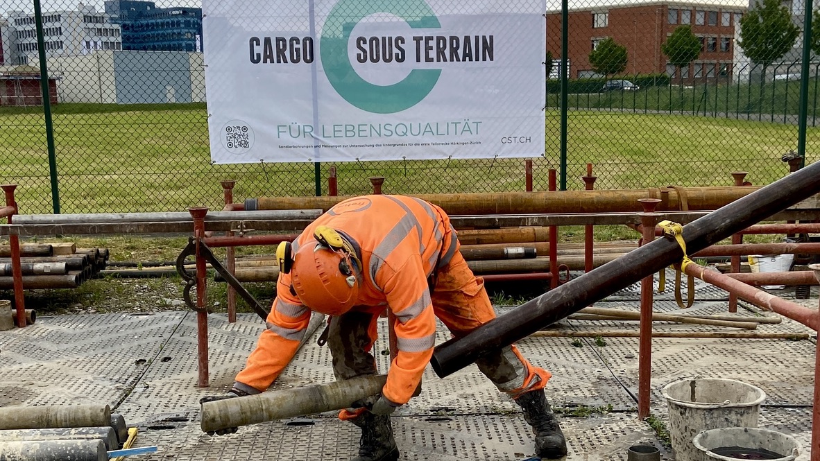
Since the beginning of 2023, Cargo sous terrain (CST) has been working in the field for the first time. With test drillings and geophysical measurements, CST is gaining precise information about the underground in order to be able to concretise the planning for the first section from Härkingen to Zurich. The work will continue until 2024 and will allow the intergenerational project to be planned with consideration for the local conditions of the ground.
WHY DOES CST CARRY OUT THESE EXAMINATIONS?
The test drillings and the geoscientific investigations of the subsoil serve to deepen and specify the knowledge about the subsoil. They investigate the possible building ground and groundwater conditions with boreholes of an average depth of 100 metres. They help to complete the geological knowledge without anticipating the precise routing of the first section. CST carries out the drilling using modern, environmentally friendly methods that minimise the impact on neighbouring residents. Apart from low noise emissions, the work will have no noticeable impact on the surrounding area. CST has also decided to make the data obtained available to the Federal Office of Topography Swisstopo free of charge. In this way, CST is expanding Switzerland’s knowledge of its subsoil in the long term.

WHAT’S A TEST DRILLING?
Drill holes allow a punctual insight into the underground and provide information about its composition. They are usually driven vertically into the subsoil. However, special methods also allow directional (curved) drilling.
Depending on the objective, a different drilling method is used. The CST drillings help to find out what the rock at depth looks like in detail. In these cases, a core drilling is carried out.
The results of the exploratory drillings are:
- Structure of the bedrock
- Thickness and composition of individual rock layers
- Depth of the rock surface in the subsoil
- Presence, nature and composition of possible groundwater
HOW IS INFORMATION OBTAINED?
Information from the subsurface is collected from:
Drill cores (mostly compact stones)
Drilled material (usually pieces of rock)
Borehole logs
Measurements of the drilling progress itself
For borehole logging and measurements, special sensors and equipment are lowered into the borehole. The resulting signals can be assigned to the corresponding depth and provide information about the surrounding rock or existing groundwater.
Since drillings - especially core drillings - are very expensive, the data obtained is usually archived to be available for later questions.
WHAT REMAINS BEHIND?
If it is purely an exploratory drilling for research purposes or to characterise the conditions in the subsurface, the hole is completely backfilled and sealed after completion, and the drilling site above it is completely dismantled and renaturalised. In these cases, everything is restored as if nothing had ever happened.
Sometimes, however, the borehole is needed for other purposes after completion, for example:
- Groundwater well
- Groundwater monitoring
- Monitoring of slope movements
In these cases, the remaining elements depend on the intended use. Anything is possible, from a simple manhole cover to a well house or even a larger installation.
WHAT'S A TEST DRILLING?
Drill holes allow a punctual insight into the underground and provide information about its composition. They are usually driven vertically into the subsoil. However, special methods also allow directional (curved) drilling.
Depending on the objective, a different drilling method is used. The CST drillings help to find out what the rock at depth looks like in detail. In these cases, a core drilling is carried out.
The results of the exploratory drillings are:
- Structure of the bedrock
- Thickness and composition of individual rock layers
- Depth of the rock surface in the subsoil
- Presence, nature and composition of possible groundwater
HOW IS INFORMATION OBTAINED?
Information from the subsurface is collected from:
Drill cores (mostly compact stones)
Drilled material (usually pieces of rock)
Borehole logs
Measurements of the drilling progress itself
For borehole logging and measurements, special sensors and equipment are lowered into the borehole. The resulting signals can be assigned to the corresponding depth and provide information about the surrounding rock or existing groundwater.
Since drillings - especially core drillings - are very expensive, the data obtained is usually archived to be available for later questions.
WHAT REMAINS BEHIND?
If it is purely an exploratory drilling for research purposes or to characterise the conditions in the subsurface, the hole is completely backfilled and sealed after completion, and the drilling site above it is completely dismantled and renaturalised. In these cases, everything is restored as if nothing had ever happened.
Sometimes, however, the borehole is needed for other purposes after completion, for example:
- Geothermal probe
- Groundwater well
- Groundwater monitoring
- Monitoring of slope movements
- Extraction of hydrocarbons or geothermal energy
In these cases, the remaining elements depend on the intended use. Anything is possible, from a simple manhole cover to a well house or even a larger installation.
GEOELECTRICS
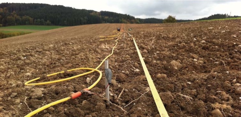
In geoelectric measurements, electrodes are inserted into the ground at the surface and electrical pulses are sent. If the measured values are visualised, a " 2D map" of the ground is obtained. Without drilling, it is possible to look into the underground and make initial statements about the course and properties of the layers.
WHAT IS BEING MEASURED?
Geoelectric measurements map the rock surface, loose rock flows and groundwater aquifers. The ground beneath our feet is made up of different layers with different physical properties. One of the most meaningful physical measurements is the electrical resistivity. Different materials have different electrical resistances. Gravel, for example, has a high electrical resistance, while clay has a comparatively low one. From the measured values obtained from this, a subsoil model can be created that makes the geological layers visible and allows conclusions to be drawn about possible groundwater.
HOW IS MEASUREMENT TAKEN?
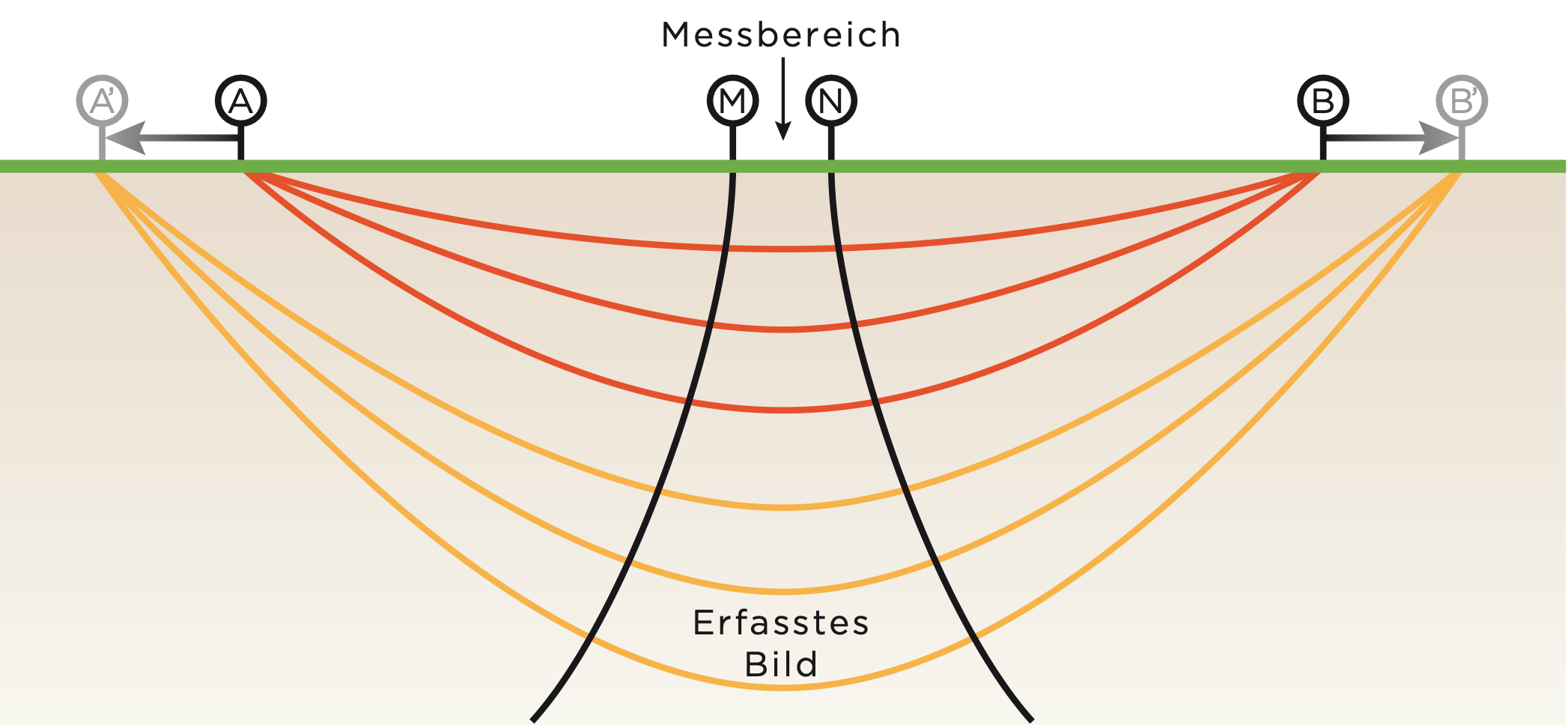
In geoelectric measurements, current is injected between two current electrodes and the voltage is measured. In this way, the resistivity can be calculated. This is an important physical property of geological layers.
The greater the distance between the two current electrodes, the greater the depth of investigation. In 2D tomography, many electrodes are placed along a profile. As a result, "2D maps" of the subsurface are obtained, on which the various electrical resistances of the individual layers are shown.

HYBRID SEISMICS
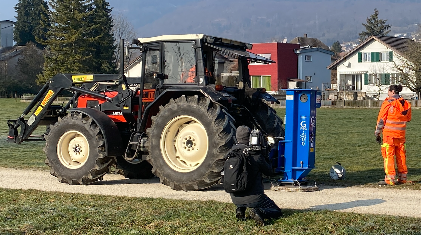
Hybrid seismics is usually carried out either with drop weights or with very small explosions. In the process, measuring devices (geophones) register vibration waves that are deflected differently by different layers. The imaging creates a seismic "2D map" of the subsurface, analogous to geoelectrics, with insights into layer progressions and properties without having to effectively drill.

WHAT IS BEING MEASURED?
Each geological layer underground has different physical properties. Similar to a lens that refracts light rays, the individual layers of earth in the ground can deflect seismic vibration waves. Measuring devices ("geophones") installed on the surface can record vibrations and thus calculate the course of individual layers.
HOW IS MEASUREMENT TAKEN?
In seismic studies, seismic waves are artificially generated and sent into the ground. The source can be either the impact of a large hammer or a drop weight attached to a tractor, or micro-blasts near the surface. In the ground, the seismic waves are deflected ("refracting") at layer boundaries or reflected back ("reflecting") from prominent layer boundaries. At the earth's surface, the deflected seismic waves are recorded by geophones.

